New FEMA Floodplain Maps
Your Insurance Could Change!
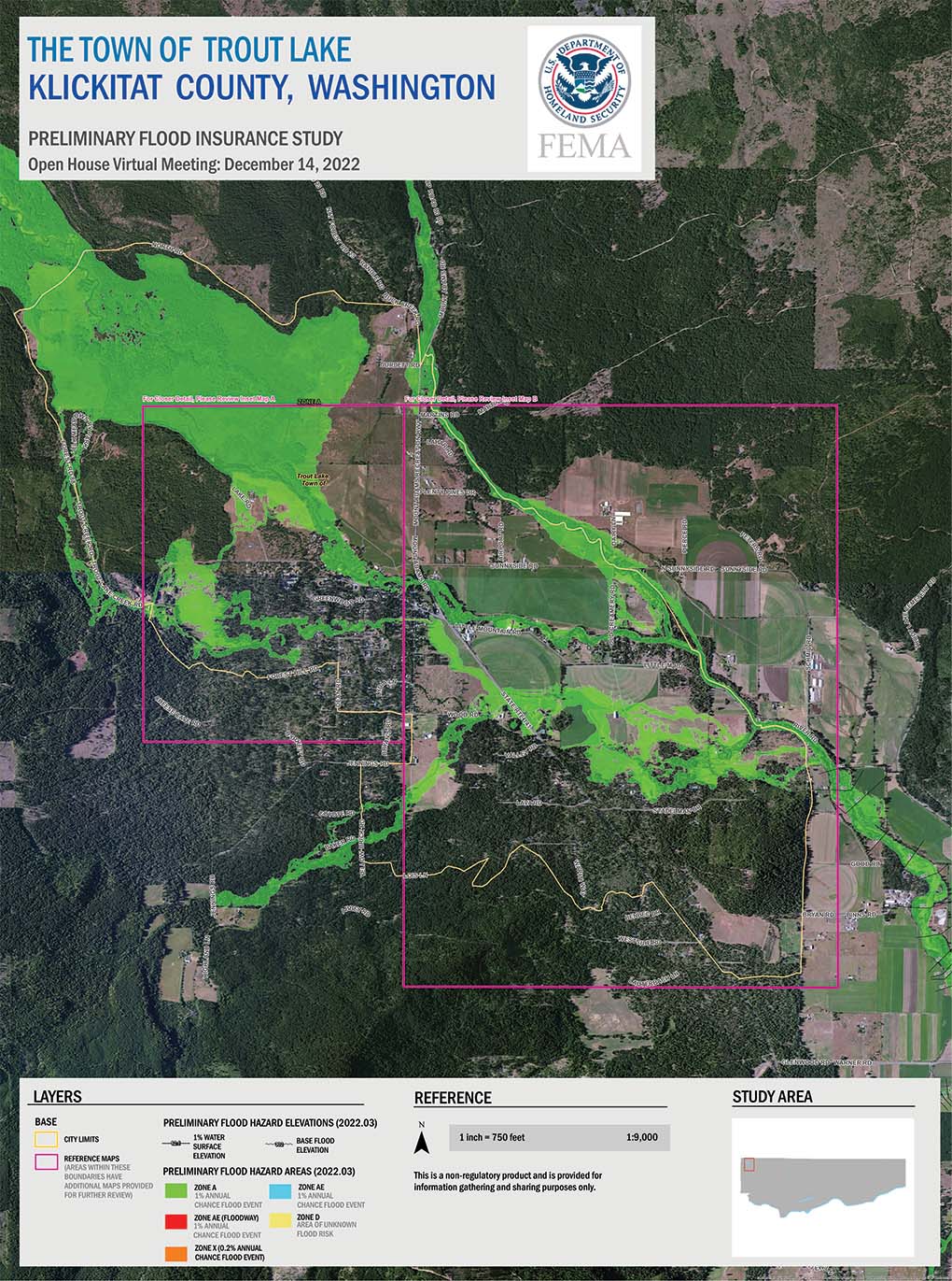
FEMA is working with the state of Washington, Klickitat County, and local communities to use new data and technology to update your Flood Insurance Rate Map (FIRM). The new map will better represent the risk of flooding and help you make informed decisions about how to protect yourself against damage and loss.
At this time, the updated flood map is “preliminary.” Review them below. This means that it is in draft form and open for public review and input. Once FEMA addresses all comments and appeals on the map and your community adopts it, the new FIRM will go into effect.
View Preliminary Maps
You can request a detailed Property ID Map specific to your property address below.

See Description for Insets and Detailed Maps
Request Your Property Map
To request a Property ID Map showing whether your property is near a Special Flood Hazard Area, please email your name and property address to: PropertyIDMap@starr-team.com.
When reaching out, please provide the following information, either in the subject line or within the body of the email.
- Property Address | Street, Community, State
- Request | Property ID Map
If requesting maps for multiple properties, please provide all addresses of interest.
Along with personalized flood and property maps, this team can also assist with the following:
- Learning how mapping hazards have changed with the map update
- Learning more about the effective, or current, Flood Insurance Rate Maps (FIRMs)
- Gather information about Base Flood Elevation (BFEs)
- Understanding what flood zone designations mean